
Cnoc Ghleann Gheis [Glengesh Hill]
Good walks are even better shared.
Overview
Cnoc Ghleann Gheis [Glengesh Hill]
Cnoc Ghleann Gheis, or Glengesh Hill, is a delightful Marilyn situated in County Donegal's splendid Bluestack Mountains. With an elevation of 431 meters, this hill is a gem for walkers looking for a rewarding and picturesque hike.
Geology
The hill is primarily composed of schist and quartzite. These geological features create a rugged yet stunning landscape, typical of the area, serving as a backdrop for various walks and wildlife spotting.
Hiking Routes
The most popular route begins at Glengesh Pass. This moderate 6 km hike takes approximately 3.5 hours. As you ascend, the vistas unfold beautifully, leading to the summit where the prominent cairn awaits, along with a notable trig point. Pack a bite and enjoy a little break as you soak in the sights.
Summit Features
Upon reaching the summit, the large cairn provides a perfect resting spot. It’s both a great photo opportunity and an excellent landmark to celebrate your achievement!
Terrain Type
Expect mostly grassy paths interspersed with rocky stretches and occasionally boggy conditions, particularly after a downpour. Good footwear is a must to help navigate these versatile landscapes.
Scenic Views
The views from Cnoc Ghleann Gheis are stunning, showcasing the captivating Bluestack Mountains and extending to Lough Eske and the distant coastline when conditions permit. Late spring and early autumn afford the best landscapes as the bloom catches the light beautifully.
Hazards
While hiking, keep an eye on the weather; conditions can change from splendid to spotty quickly. Also, be cautious of the uneven terrain, especially in muddy patches that can surprise even the most seasoned hiker.
Nearby Summits
Nearby, you can find Bencorragh, standing at 570 meters, and Topped Mountain at 495 meters, both of which offer additional hiking opportunities for those wishing to extend their adventure.
Access and Facilities
Parking is available at Glengesh Pass, but it tends to fill up, so aim for an early start. Ardara, the nearest town, has several cafes and shops for post-hike sustenance and public toilets to freshen up.
Historical Significance
The name translates to 'Hill of the Glen of the Geese,' giving a nod to its connection with local wildlife. Cnoc Ghleann Gheis has become a beloved spot for both locals and visitors, enriching the cultural landscape of the area.
In conclusion, Cnoc Ghleann Gheis offers an inviting and picturesque challenge for walkers of all levels. Dust off your hiking boots, pack some provisions, and get ready to explore a piece of Donegal’s stunning outdoors.
Explore routes near Cnoc Ghleann Gheis [Glengesh Hill]
Public walks starting within 80 km of this hill. Nearby does not mean a route reaches the summit; check its map and access before setting out.
Florence Court: Riverside and Forest Circuit, County Fermanagh
View route
Derry~Londonderry City Walls Circuit
View route
Route planning notes
These notes describe possible approaches, not verified navigable routes or permission to cross land. Check current paths, local access rules and conditions before setting out.
Glengesh Pass Route
This route starts from Glengesh Pass, offering a scenic hike through lush valleys and rocky terrain before ascending to the summit.
Make a day of it, together
Find someone to share the walk with, or organise a day out along a route you like.
Hill facts and local notes
Classifications
Elevation
390m
1,280 ft
Prominence
126m
Coordinates
54.7454, -8.4635
G702887
OS Map
10
At the Summit
The summit features a large, distinctive cairn that provides a great spot for a well-deserved rest and some photo opportunities. A trig point can also be found nearby, giving a sense of accomplishment for those who reach it.
Terrain & Geology
Cnoc Ghleann Gheis is composed primarily of schist and quartzite, providing a rugged and interesting landscape typical of the region. The unique geological formations contribute to the varied landforms and rich biodiversity found in the area.
Views & Scenery
From the summit, enjoy panoramic views of the Bluestack Mountains, and on a clear day, you may also spot Lough Eske and the distant Atlantic coastline.
History & Heritage
Name Origin
Cnoc Ghleann Gheis translates to 'Hill of the Glen of the Geese,' which is indicative of the area's natural fauna.
Historical Significance
The mountain holds cultural significance due to its location in the scenic Bluestack range, often visited by hikers and nature lovers across Ireland.
Getting There & Facilities
Check current local access restrictions, parking rules and transport timetables before travelling. These notes do not confirm public access to the summit.
Parking
There is a small parking area at Glengesh Pass, suitable for a few cars. Arriving early is recommended, as it can fill up quickly on weekends.
Public Transport
Public transport options are limited; the nearest bus connection can be found in Donegal Town, roughly 20 km away.
Nearby Facilities
In Ardara, you can find cafes and shops for refreshments after your hike, with several offering traditional Irish fare. Public toilets are available within the town.
Safety Information
Known Hazards
- Be mindful of changing weather conditions, as they can transform a clear day into a foggy challenge quite quickly. Also watch for uneven terrain, particularly in wetter months.
General Safety Tips
- Check weather conditions before setting out
- Carry appropriate clothing and equipment
- Let someone know your planned route
- Take a map, compass, and GPS device
- Carry emergency supplies: food, water, first aid kit, torch
Hills
Some common questions about the hills answered
Are there group walks up Cnoc Ghleann Gheis [Glengesh Hill]?
Many walkers use Walkmates to join or organise walks with others. You can check for group walks around Cnoc Ghleann Gheis [Glengesh Hill] through the maps
Are there other walkers around Cnoc Ghleann Gheis [Glengesh Hill]?
Activity varies by location and time, but Walkmates lets you see whether others have shared walks or shown interest in this area. Find other people through the walking friends search walking friends for Cnoc Ghleann Gheis [Glengesh Hill] search or of course create your own walk for Cnoc Ghleann Gheis [Glengesh Hill]
Can I organise a walk to Cnoc Ghleann Gheis [Glengesh Hill]?
Yes. If there aren’t any walks listed already, you can create a walk and make it available for others to join.
If you're signed up to Walkmates, you can create a walk to Cnoc Ghleann Gheis [Glengesh Hill].
How do I find a walk up this hill?
There are often multiple ways to walk this hill, depending on experience and route preference. Walkmates helps you explore walks and routes that others have shared.
Can I suggest a new route up Cnoc Ghleann Gheis [Glengesh Hill]?
Yes. You can suggest or create routes to share with others. Walkmates focuses on the social side of walking, so routes are used to help people organise walks and explore areas together, rather than as detailed navigation tools or route libraries.
Other uses really appreciate knowledgeable walkers sharing their routes. Share your favourite route to Cnoc Ghleann Gheis [Glengesh Hill] here
The is an error or something incorrect about this hill. How do I let you know?
We always strive to keep the information on Walkmates as accurate as possible. If you find an error, please let us know through the contact form and we'll aim to correct it as quickly as possible
Community Discussion
Comments
Location
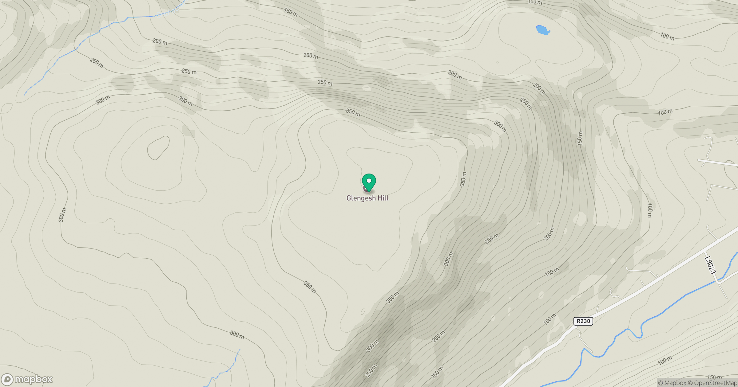
Grid reference: G702887
View on OpenStreetMapOpens a map in a new tab, centred on the hill.
Hills within 30 km
Straight-line distance, not a walking route or confirmation of access.
No comments yet. Be the first.